EarthRanger
Protecting wildlife with real-time data
EarthRanger is a software solution that aids protected area managers, ecologists, and wildlife biologists in making more informed operational decisions for wildlife conservation.
EarthRanger is a cutting-edge
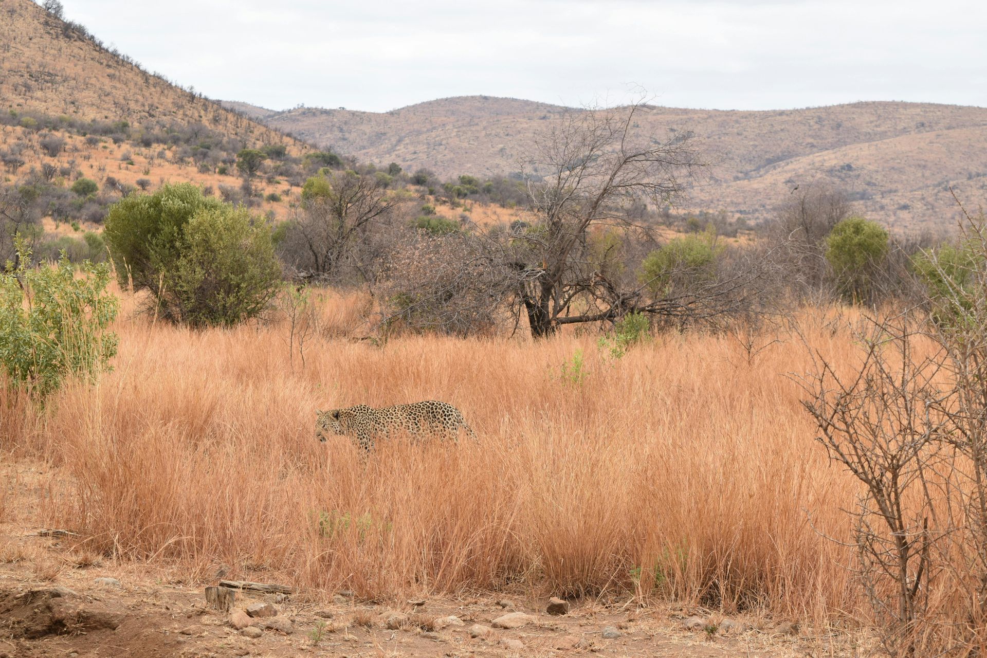
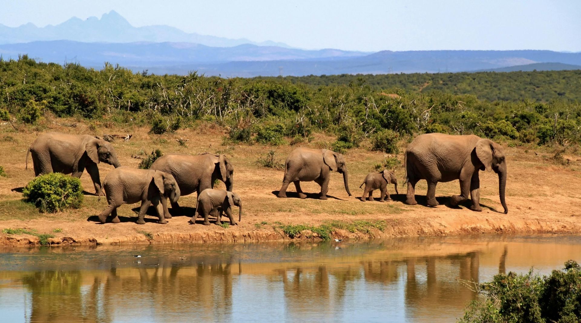
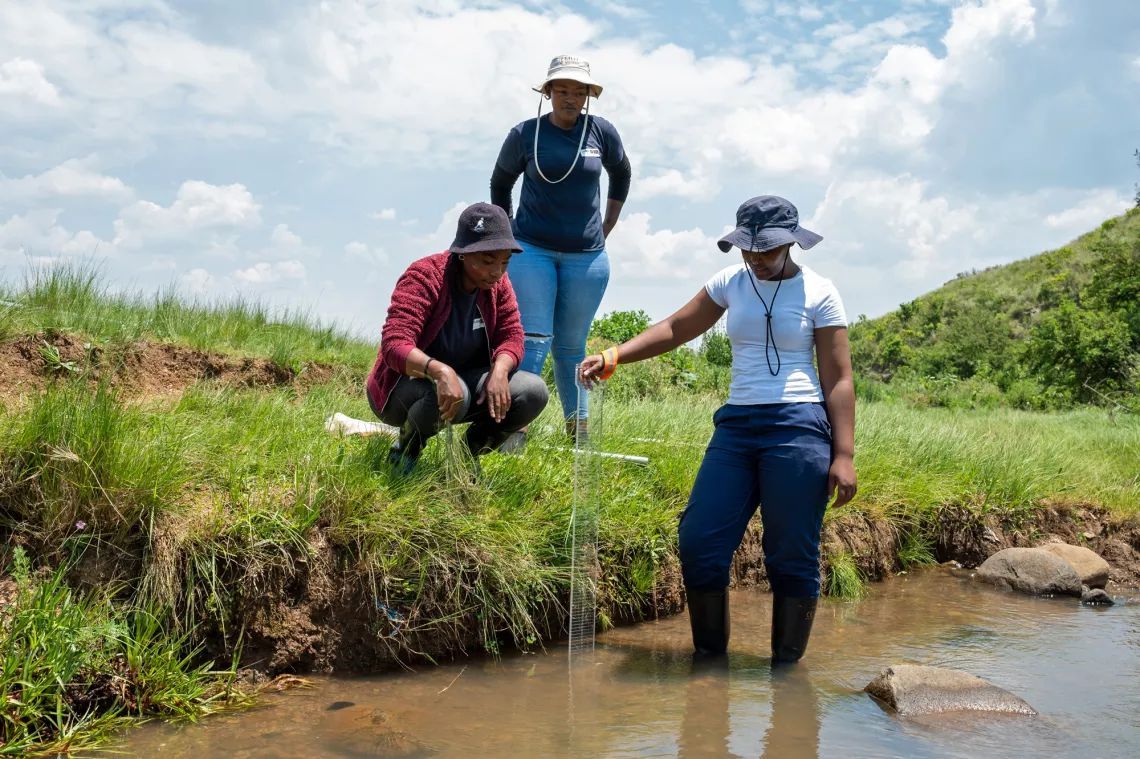
conservation software solution designed to empower protected area managers, ecologists, and wildlife biologists with real-time data to make informed decisions for wildlife conservation. As conservation challenges such as deforestation, poaching, climate change, and illegal wildlife trade escalate, the need for a comprehensive tool like EarthRanger becomes increasingly critical. By integrating and visualizing historical and real-time data from various sources, EarthRanger provides a unified view of wildlife movements, ranger activities, and other key assets within a protected area, enabling more effective conservation strategies.
Key Features
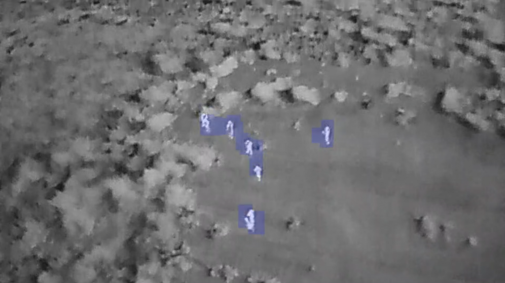
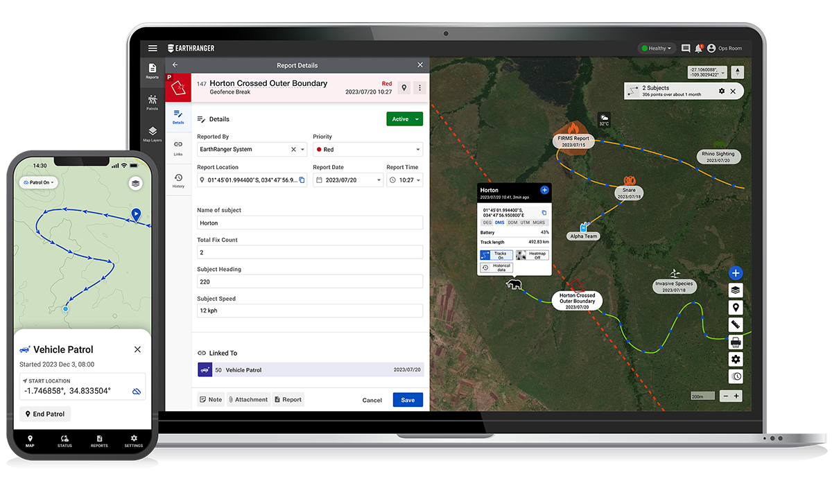
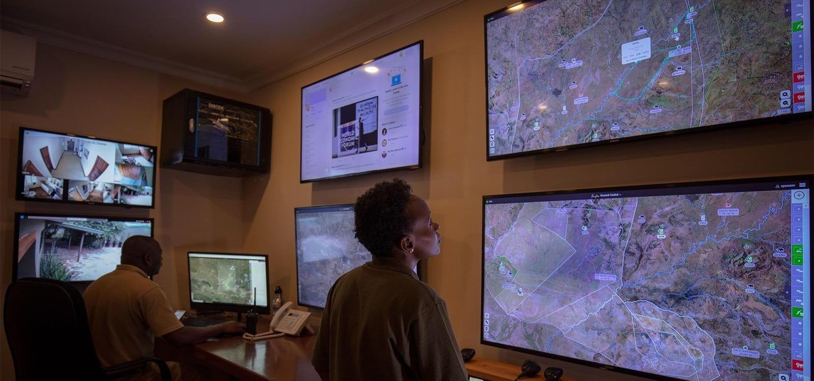
- Real-time Visualization: Collects and displays data from sensors, mobile devices, and field reports in real-time, providing a comprehensive overview of activities within a protected area.
- Enhanced Collaboration: Facilitates data sharing and collaboration between multiple team members and neighboring protected areas for coordinated efforts.
- Informed Patrol Planning: Uses real-time and historical data to guide patrol planning and increase effectiveness.
- Ecological Trend Analysis: Analyzes data to identify trends in animal behavior, ecological changes, and habitat conditions.
- Customizable Alerts: Allows configuration of alerts via WhatsApp, email, or text message for timely responses to incidents.
- Mobile Device Support: Accessible on various devices including tablets and phones, with a mobile app for real-time tracking and event reporting.
- Integrated Data: Supports integration with over 70 hardware devices and multiple software platforms for a holistic view of conservation data.
- User-friendly Interface: Requires minimal training and no IT staff, with an intuitive, web-based platform.
- Dedicated Support: Offers a dedicated team to assist with implementation and ongoing support.
Detailed Overview of EarthRanger
Real-time Visualization for Effective Management
EarthRanger excels in providing a real-time, unified view of all activities within a protected area. By integrating data from various sources—including sensors, ranger patrols, and field reports—the software delivers an up-to-date, comprehensive picture that enables protected area managers to monitor wildlife, assess threats, and deploy resources more effectively. This capability is particularly valuable for responding to poaching incidents and other security threats in a timely manner.
Enhanced Collaboration Across Protected Areas
One of EarthRanger's standout features is its ability to foster collaboration between multiple teams and protected areas. The software allows data to be shared seamlessly, enabling joint patrol missions and coordinated responses to incidents. This collaborative approach not only enhances the security of protected areas but also promotes regional conservation efforts by ensuring that data and resources are utilized optimally.
Informed Patrol Planning and Ecological Management
EarthRanger leverages both real-time and historical data to inform patrol planning and track the effectiveness of conservation efforts. By analyzing this data, managers can make evidence-based decisions that enhance the protection of wildlife and their habitats. Additionally, the software’s ability to analyze habitat trends provides critical insights into ecological changes, helping managers to adapt their strategies in response to evolving environmental conditions.
Mobile Access and Configurable Alerts
The flexibility of EarthRanger extends to its support for mobile devices, allowing managers and rangers to access data and receive alerts on the go. The EarthRanger mobile application enables real-time tracking, event reporting, and patrol management directly from the field, even in remote areas without radio or satellite communication. Alerts can be customized to suit specific needs, ensuring that critical information is delivered promptly and to the right people.
Seamless Data Integration and Security
With integrations to over 70 hardware devices and numerous software platforms, EarthRanger provides a comprehensive view of conservation data. This level of integration is crucial for building a holistic understanding of conservation areas and facilitating further analysis with tools like Esri and Tableau. Moreover, EarthRanger ensures that sensitive data is kept secure, with configurable access controls that allow managers to decide who can view or edit information.
User-friendly Design and Dedicated Support
EarthRanger is designed to be accessible and easy to use, requiring no specialized IT staff for operation. The web-based platform is intuitive, with visual tools that simplify training for rangers and managers. In addition, EarthRanger offers dedicated support to assist with the implementation and successful deployment of the software, ensuring that conservation teams can focus on their mission without technical hurdles.
About EarthRanger
Since its inception in 2015, EarthRanger has helped protected area managers make informed, conservation-related operational decisions. It is also used by ecologists and biologists to study wildlife and habitats, and to advocate for their protection.
Developed by Vulcan LLC, in partnership with many conservation and technology partners, it is a software solution that combines real-time data from ranger patrols, remote imaging and many, various sensors. As of September 2021, EarthRanger is a product of Ai2. This move combines world-class research, engineering, product resources and talent to create greater positive impact, as envisioned by the late Paul G. Allen.
All information, images and videos sourced from
https://www.earthranger.com/
Share this article
Quicklinks